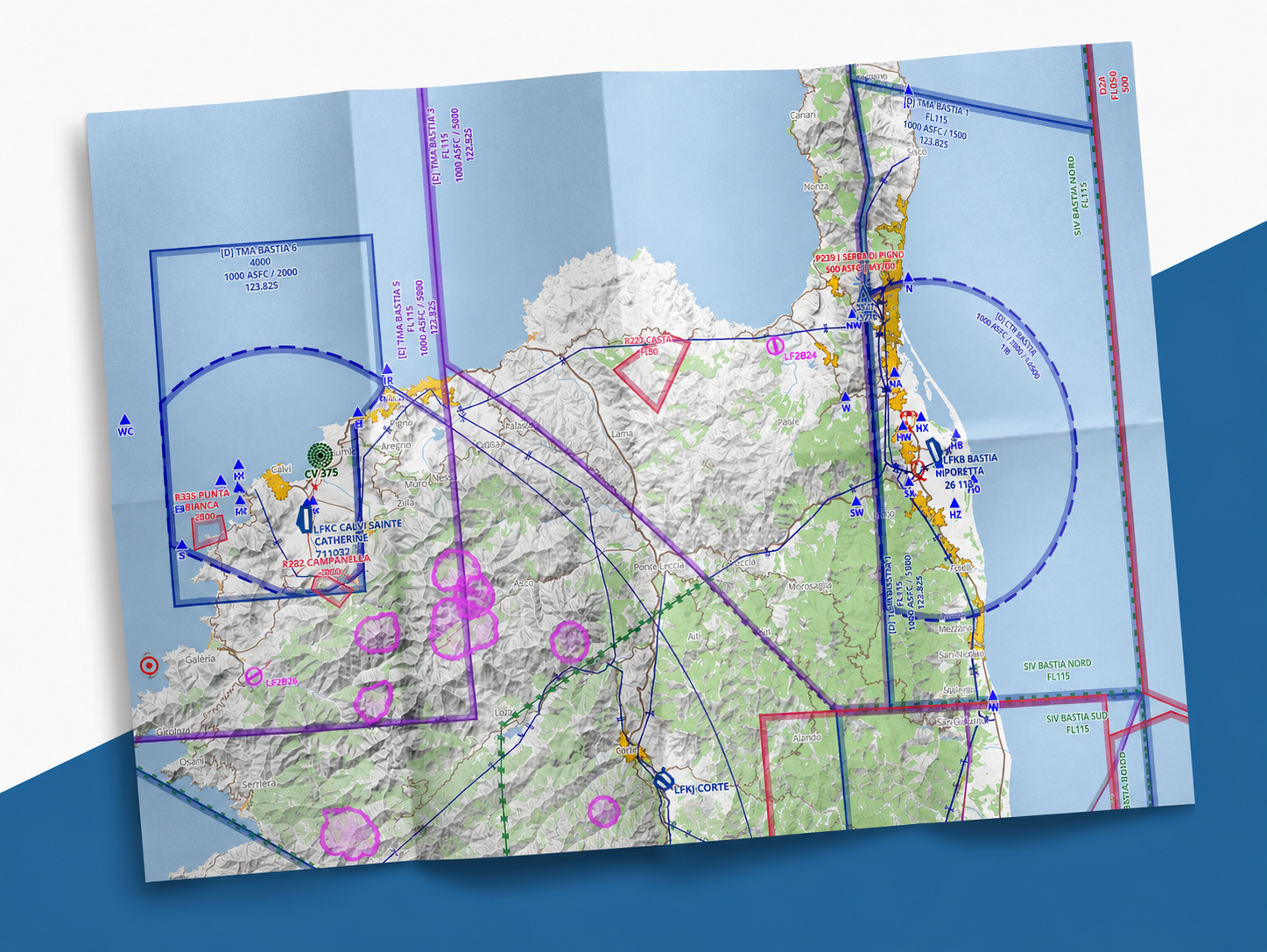
SDOACI is our in-house aeronautical chart, designed to provide a clear and consistent view of the airspace, directly integrated into SDVFR Next.
It brings together the essential aeronautical information needed for VFR flight preparation and monitoring: airspaces, restricted, dangerous or prohibited areas, aerodromes, reporting points, obstacles, frequencies, radio navigation aids, as well as many other useful navigation details.
The goal is not only to display data, but to make it readable, consistent and usable by the pilot. Each element is carefully designed to strike the right balance between information richness and chart clarity.
SDOACI covers a large part of Europe and forms the aeronautical mapping foundation used in our applications. It complements the official charts available in SDVFR Next by providing a consistent, modern representation designed for digital use.
As always in aviation, data that is almost up to date is false data. This is why we review every AIRAC cycle to identify important changes and maintain a reliable chart for pilots.
- Airspaces (CTR, TMA, CTA, P, D, R, CBA, RTBA, ZIT, RMZ, TMZ) with lower limit strictly below FL115
- Aerodromes
- Aerodrome and airspace frequencies (when the frequency is confirmed with certainty)
- Navaids: VOR, VORD, VORTAC, NDB, TACAN
- Obstacles with a height greater than or equal to 300 feet (>= 250 feet at the final zoom level of the map)
- Aerobatic axes
- Parachute drop zones
- Cables & winch launch zones (tethered balloons are not displayed)
- Map background showing terrain elevation (color-coded)
- Shapes of populated urban areas (recent data!)
- National parks / Nature reserves (only zones declared by the SIA)
- Industrial & sensitive areas forbidden to overfly below 1000 ft ASFC
- Main hydrographic network
- Primary & secondary road network
- Main railway network
- Electrical grid (high voltage only)
- Lakes & water reservoirs
- Forested areas
- Coastal flats
- "Multi-zoom" management to avoid information overload